1970 Map of Lost Bridge
USGS Topo · Published 1973About this map
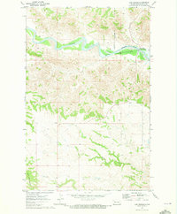
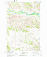
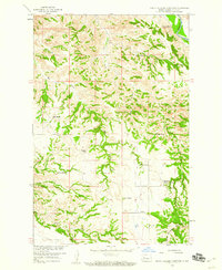
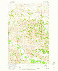
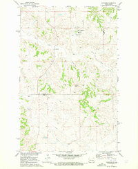
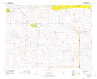
The Little Missouri River carves a winding path through the Badlands of western North Dakota, marking a landscape of significant elevation changes and seasonal watercourses. At the time of this 1970 field check, the river transitions into the rising waters of Lake Sakakawea Elevation 1838, an artificial reservoir created by the Garrison Dam. This inundation boundary is a defining feature of the area, as the water reaches up into the coulees and draws of the surrounding terrain. To the south, the massive landform of North Killdeer Mountain stands as a prominent landmark overlooking the drainage basins of Corral Creek. The northeastern portion of the map is defined by the Fort Berthold Indian Reservation Boundary, while the Lost Bridge Public Use Area provides a specific point of access to this remote riverine environment before the further development of the region's infrastructure.
Find a feature on this map
8 named features on this map. Tap any name to fly to it.
Don’t see what you’re looking for? This feature index may not catch every label — zoom into the map to look around manually.
Map Details
Editions of this 1970 Lost Bridge Map
2 editions found
Other maps of this area

1953 · Watford City
USGS Topo · 1:250,000

1957 · Watford City
USGS Topo · 1:250,000
1958 · North Killdeer Mountain
USGS Topo · 1:24,000
1959 · Croff
USGS Topo · 1:24,000

1967 · Watford City
USGS Topo · 1:250,000
1970 · Mandaree
USGS Topo · 1:24,000
1970 · Figure 4 Ranch
USGS Topo · 1:24,000
1970 · Dunn Center NW
USGS Topo · 1:24,000
1970 · Mandaree SW
USGS Topo · 1:24,000
1974 · Killdeer
USGS Topo · 1:100,000