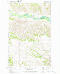
1970 Map of Lost Bridge
USGS Topo · Published 1979About this map
Lake Sakakawea dominates the northern landscape of this Dunn County region, marking the controlled inundation of the Little Missouri River valley. The map provides a detailed look at the Fort Berthold Indian Reservation Boundary as it intersects with the rugged topography of western North Dakota. To the south, the terrain rises toward North Killdeer Mountain, while the drainage of Corral Creek carves through the breaks. Geologic and recreational interests are highlighted by the Lost Bridge Public Use Area, situated where the river transitions into the reservoir. This 1970 field-checked survey preserves the character of the badlands terrain before further modern development, showing the isolated Spring and fence lines that defined local land use during this era.
Find a feature on this map
8 named features on this map. Tap any name to fly to it.
Don’t see what you’re looking for? This feature index may not catch every label — zoom into the map to look around manually.
Map Details
Editions of this 1970 Lost Bridge Map
2 editions found
Other maps of this area

1953 · Watford City
USGS Topo · 1:250,000

1957 · Watford City
USGS Topo · 1:250,000

1958 · North Killdeer Mountain
USGS Topo · 1:24,000

1959 · Croff
USGS Topo · 1:24,000

1967 · Watford City
USGS Topo · 1:250,000

1970 · Mandaree
USGS Topo · 1:24,000

1970 · Lost Bridge
USGS Topo · 1:24,000

1970 · Figure 4 Ranch
USGS Topo · 1:24,000

1970 · Dunn Center NW
USGS Topo · 1:24,000

1970 · Mandaree SW
USGS Topo · 1:24,000