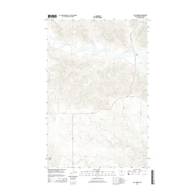
2014 Map of Lost Bridge
USGS Topo · Published 2014About this map
Little Missouri River carves through the heart of this landscape, a prominent waterway that defines the drainage patterns of Dunn County. This 2014 survey documents the rugged Badlands-style terrain where the river meets the namesake Lost Bridge, a critical crossing point on Nd-22. To the southwest, the elevation rises sharply toward North Killdeer Mtn, a significant landmark that overlooks the surrounding plains. The map illustrates a network of rural routes, including 10th St NW and 105th Ave NW, which connect the high plateau areas with the intricate creek systems of Corral Cr and Frank Cr. This documentation captures the intersection of topography and transportation in a region shaped by its geology and the necessity of river passage.
Find a feature on this map
11 named features on this map. Tap any name to fly to it.
Don’t see what you’re looking for? This feature index may not catch every label — zoom into the map to look around manually.
Map Details
Editions of this 2014 Lost Bridge Map
This is the sole edition of this map. No revisions or reprints were ever made.
Other maps of this area

1953 · Watford City
USGS Topo · 1:250,000

1957 · Watford City
USGS Topo · 1:250,000

1958 · North Killdeer Mountain
USGS Topo · 1:24,000

1959 · Croff
USGS Topo · 1:24,000

1967 · Watford City
USGS Topo · 1:250,000

1970 · Mandaree
USGS Topo · 1:24,000

1970 · Lost Bridge
USGS Topo · 1:24,000

1970 · Figure 4 Ranch
USGS Topo · 1:24,000

1970 · Dunn Center NW
USGS Topo · 1:24,000

1970 · Mandaree SW
USGS Topo · 1:24,000