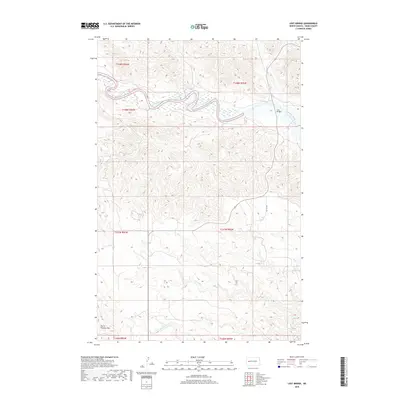
2018 Map of Lost Bridge
USGS Topo · Published 2018About this map
Little Missouri River meanders through the northern section of this Dunn County landscape, carving a prominent valley across the badlands. The terrain is defined by dramatic elevation changes, most notably at North Killdeer Mtn in the southwestern corner. This area, located within the Mandaree region, remains largely undeveloped with a sparse road network represented primarily by 107th St NW. The settlement of Lost Bridge sits near the river's eastern bend, serving as a rare point of reference in a territory dominated by natural drainages like Corral Cr and Frank Cr. The map's grid of section lines and township boundaries, including t148n r95w and t147n r96w, illustrates the systematic division of this rural North Dakota interior.
Find a feature on this map
12 named features on this map. Tap any name to fly to it.
Don’t see what you’re looking for? This feature index may not catch every label — zoom into the map to look around manually.
Map Details
Editions of this 2018 Lost Bridge Map
This is the sole edition of this map. No revisions or reprints were ever made.
Other maps of this area

1953 · Watford City
USGS Topo · 1:250,000

1957 · Watford City
USGS Topo · 1:250,000

1958 · North Killdeer Mountain
USGS Topo · 1:24,000

1959 · Croff
USGS Topo · 1:24,000

1967 · Watford City
USGS Topo · 1:250,000

1970 · Mandaree
USGS Topo · 1:24,000

1970 · Lost Bridge
USGS Topo · 1:24,000

1970 · Figure 4 Ranch
USGS Topo · 1:24,000

1970 · Dunn Center NW
USGS Topo · 1:24,000

1970 · Mandaree SW
USGS Topo · 1:24,000