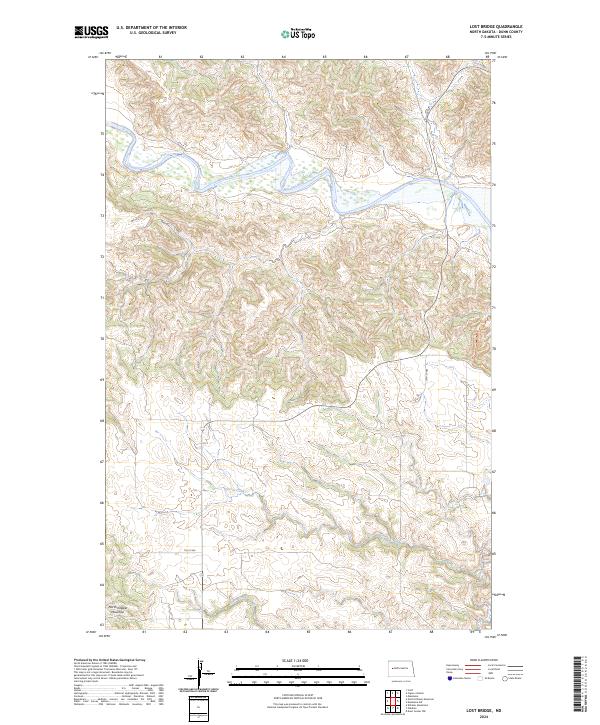
2024 Map of Lost Bridge
USGS Topo · Published 2024About this map
The Little Missouri River carves a deep path through the badlands of western North Dakota, dominating the northern reaches of this landscape. The terrain is defined by the sharp verticality of North Killdeer Mountain in the southwest, a landmark that towers over the surrounding drainage basins. This modern topographic study shows the remote character of Dunn County, where the intricate network of coulees and ridges feeds into seasonal watercourses such as Corral Creek and Frank Creek. Apart from the rural transit corridors of 7th St NW and 10th St NW, the map reflects a primarily undeveloped area where the original Public Land Survey System grids, such as t147n r96w, provide the primary structure for land navigation.
Find a feature on this map
12 named features on this map. Tap any name to fly to it.
Don’t see what you’re looking for? This feature index may not catch every label — zoom into the map to look around manually.
Map Details
Editions of this 2024 Lost Bridge Map
This is the sole edition of this map. No revisions or reprints were ever made.
Other maps of this area

1953 · Watford City
USGS Topo · 1:250,000

1957 · Watford City
USGS Topo · 1:250,000

1958 · North Killdeer Mountain
USGS Topo · 1:24,000

1959 · Croff
USGS Topo · 1:24,000

1967 · Watford City
USGS Topo · 1:250,000

1970 · Mandaree
USGS Topo · 1:24,000

1970 · Lost Bridge
USGS Topo · 1:24,000

1970 · Figure 4 Ranch
USGS Topo · 1:24,000

1970 · Dunn Center NW
USGS Topo · 1:24,000

1970 · Mandaree SW
USGS Topo · 1:24,000