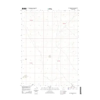
2015 Map of Lost Creek Butte SW
USGS Topo · Published 2015About this map
Red Desert Basin characterizes this section of the Wyoming high desert, a landscape defined by its subtle drainage patterns and vast openness. The hydrology is dominated by Red Wash Draw, which meanders through the southern portion of the quadrangle, illustrating the ephemeral nature of water in this arid environment. Transportation across the basin is sparse, anchored primarily by Red Desert Rd in the southeast corner. The survey meticulously documents the township and range system, including t22n r96w and t21n r95w, providing a clear geometric framework for the land management of Sweetwater County. The topographic detail reveals a series of low-lying buttes and depressions that dictated the movement of early travelers and livestock through this remote corridor.
Find a feature on this map
7 named features on this map. Tap any name to fly to it.
Don’t see what you’re looking for? This feature index may not catch every label — zoom into the map to look around manually.
Map Details
Editions of this 2015 Lost Creek Butte SW Map
This is the sole edition of this map. No revisions or reprints were ever made.
Other maps of this area

1954 · Rock Springs
USGS Topo · 1:250,000

1958 · Rock Springs
USGS Topo · 1:250,000

1960 · Red Lake
USGS Topo · 1:62,500

1960 · Lost Creek Butte
USGS Topo · 1:62,500

1962 · Rock Springs
USGS Topo · 1:250,000

1970 · Red Desert NW
USGS Topo · 1:24,000

1970 · Tipton
USGS Topo · 1:24,000
1970 · Red Desert
USGS Topo · 1:24,000
1980 · Red Desert Basin
USGS Topo · 1:100,000
1988 · Red Lake NE
USGS Topo · 1:24,000