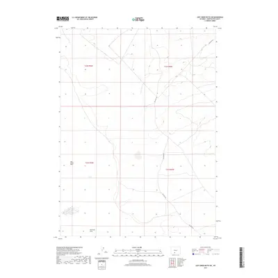
2017 Map of Lost Creek Butte SW
USGS Topo · Published 2017About this map
Red Desert Basin dominates this portion of the high desert in Wyoming, where the landscape is defined by vast drainage patterns and sparse human infrastructure. The arid terrain is characterized by features such as Red Wash Draw in the south, reflecting the complex hydrography of the region's internal drainage system. Public land management is central to this area, as indicated by the prominent township and range boundaries including t22n r96w and t21n r95w. Transportation is limited to a handful of local routes, most notably Red Desert Rd, which provides the primary access through these remote stretches of Sweetwater County. The map captures the quiet, open character of the Wyoming desert in the early twenty-first century.
Find a feature on this map
8 named features on this map. Tap any name to fly to it.
Don’t see what you’re looking for? This feature index may not catch every label — zoom into the map to look around manually.
Map Details
Editions of this 2017 Lost Creek Butte SW Map
This is the sole edition of this map. No revisions or reprints were ever made.
Other maps of this area

1954 · Rock Springs
USGS Topo · 1:250,000

1958 · Rock Springs
USGS Topo · 1:250,000

1960 · Red Lake
USGS Topo · 1:62,500

1960 · Lost Creek Butte
USGS Topo · 1:62,500

1962 · Rock Springs
USGS Topo · 1:250,000

1970 · Red Desert NW
USGS Topo · 1:24,000

1970 · Tipton
USGS Topo · 1:24,000
1970 · Red Desert
USGS Topo · 1:24,000
1980 · Red Desert Basin
USGS Topo · 1:100,000
1988 · Red Lake NE
USGS Topo · 1:24,000