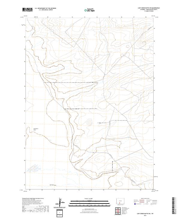
2021 Map of Lost Creek Butte SW
USGS Topo · Published 2021About this map
Red Desert Basin dominates this landscape in the high desert of Sweetwater County, Wyoming. This interior drainage basin is characterized by its isolation and specialized hydrology, as evidenced by the seasonal watercourse at Red Wash Draw in the southern portion of the quadrangle. The primary human infrastructure is represented by the winding path of Red Desert Rd, which provides access through the expansive sections of t21n r95w and t22n r95w. The map illustrates a largely uninhabited region where the Public Land Survey System grid defines the legal landscape, punctuated only by intermittent drainages and the few established roads that cross this arid terrain.
Find a feature on this map
7 named features on this map. Tap any name to fly to it.
Don’t see what you’re looking for? This feature index may not catch every label — zoom into the map to look around manually.
Map Details
Editions of this 2021 Lost Creek Butte SW Map
This is the sole edition of this map. No revisions or reprints were ever made.
Other maps of this area

1954 · Rock Springs
USGS Topo · 1:250,000

1958 · Rock Springs
USGS Topo · 1:250,000

1960 · Red Lake
USGS Topo · 1:62,500

1960 · Lost Creek Butte
USGS Topo · 1:62,500

1962 · Rock Springs
USGS Topo · 1:250,000

1970 · Red Desert NW
USGS Topo · 1:24,000

1970 · Tipton
USGS Topo · 1:24,000
1970 · Red Desert
USGS Topo · 1:24,000
1980 · Red Desert Basin
USGS Topo · 1:100,000
1988 · Red Lake NE
USGS Topo · 1:24,000