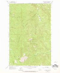
1962 Map of Lost Creek Divide
USGS Topo · Published 1969About this map
Flathead National Forest land defines this topographic survey, which was field checked in the early 1960s to reveal a landscape shaped by remote drainage systems and high ridges. The central topography is anchored by the Lost Creek Divide and the Reid Divide, which separate the watersheds of numerous mountain streams. Significant for those studying the history of forestry and fire lookout management, the map identifies the Lookout Reid Tower perched at a high elevation. Access through this wilderness was limited at the time to primitive routes, including a primary (Pack) Trail and several stretches of designated Pack Trail. From the open spaces of Mountain Meadow to the seasonal flow of Big Rhodes Draw, the map provides a precise look at the drainage patterns of Lost Creek and its many tributaries.
Find a feature on this map
14 named features on this map. Tap any name to fly to it.
Don’t see what you’re looking for? This feature index may not catch every label — zoom into the map to look around manually.
Map Details
Editions of this 1962 Lost Creek Divide Map
3 editions found
Other maps of this area

1943 · Kalispell
USGS Topo · 1:125,000

1957 · Kalispell
USGS Topo · 1:250,000

1960 · Kalispell
USGS Topo · 1:250,000

1961 · Kalispell
USGS Topo · 1:250,000

1962 · Johnson Peak
USGS Topo · 1:24,000

1962 · Blue Grass Ridge
USGS Topo · 1:24,000

1962 · Beaver Lake
USGS Topo · 1:24,000

1962 · Lost Creek Divide
USGS Topo · 1:24,000

1962 · Ashley Mountain
USGS Topo · 1:24,000

1962 · Rhodes
USGS Topo · 1:24,000