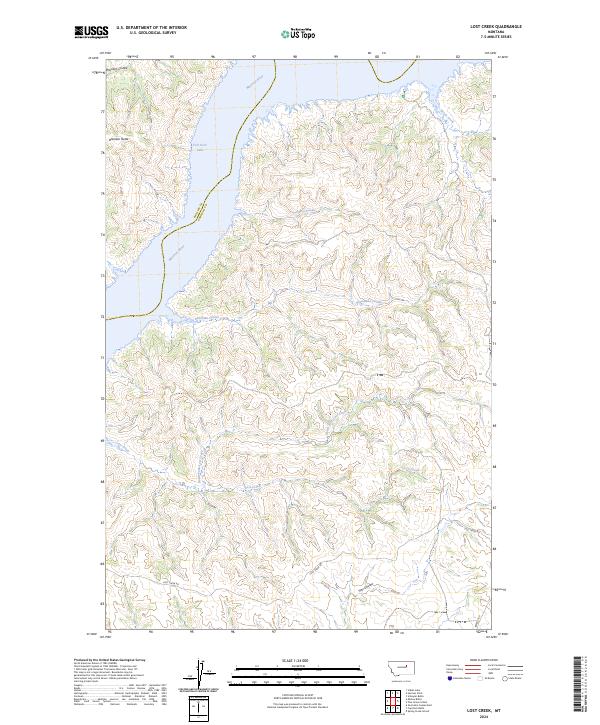
2024 Map of Lost Creek
USGS Topo · Published 2024About this map
Charles M Russell National Wildlife Refuge dominates this landscape, preserving a vast corridor of riverine habitat where the Missouri River meets the northern reaches of Fort Peck Lake. The map reveals a complex network of drainage systems, including Ghost Coulee, Deadman Coulee, and Devils Creek, which carve through the high plains toward the river valley. The topography is defined by significant elevations such as Brandon Butte, which overlooks the surrounding Brandon Coulee.
Find a feature on this map
20 named features on this map. Tap any name to fly to it.
Don’t see what you’re looking for? This feature index may not catch every label — zoom into the map to look around manually.
Map Details
Editions of this 2024 Lost Creek Map
This is the sole edition of this map. No revisions or reprints were ever made.
Other maps of this area

1954 · Jordan
USGS Topo · 1:250,000

1956 · Jordan
USGS Topo · 1:250,000

1958 · Jordan
USGS Topo · 1:250,000

1964 · Jordan
USGS Topo · 1:250,000

1965 · Germaine Coulee East
USGS Topo · 1:24,000

1965 · Spring Creek School
USGS Topo · 1:24,000

1965 · Lost Creek
USGS Topo · 1:24,000

1965 · Herman Point
USGS Topo · 1:24,000

1965 · Cap Rock Butte
USGS Topo · 1:24,000

1965 · Pine Grove School
USGS Topo · 1:24,000