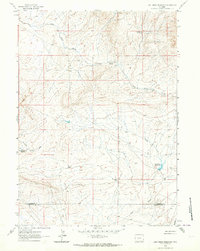
1961 Map of Lost Creek Reservoir
USGS Topo · Published 1964About this map
Lost Creek Reservoir and the surrounding high plains of the Great Divide Basin define this 1961 landscape along the boundary of Fremont and Sweetwater counties. The area is characterized by a network of intermittent drainages and essential water sources, such as Stinking Springs and its namesake Stinking Springs Reservoir. Human activity is marked by numerous prospects scattered across the terrain, indicating mineral exploration and small-scale mining efforts typical of the region's mid-century economy.
Find a feature on this map
12 named features on this map. Tap any name to fly to it.
Don’t see what you’re looking for? This feature index may not catch every label — zoom into the map to look around manually.
Map Details
Editions of this 1961 Lost Creek Reservoir Map
2 editions found
Other maps of this area

1951 · Soap Holes
USGS Topo · 1:24,000

1951 · Crooks Mountain
USGS Topo · 1:24,000

1953 · Happy Spring
USGS Topo · 1:24,000

1955 · Lander
USGS Topo · 1:250,000

1955 · Casper
USGS Topo · 1:250,000

1958 · Casper
USGS Topo · 1:250,000

1958 · Lander
USGS Topo · 1:250,000

1960 · Lost Creek Lake
USGS Topo · 1:62,500

1961 · Lander
USGS Topo · 1:250,000
1961 · Olson Springs
USGS Topo · 1:24,000