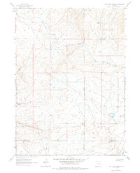
1961 Map of Lost Creek Reservoir
USGS Topo · Published 1978About this map
The high desert landscape of Fremont and Sweetwater Counties is defined by a sparse but essential network of water sources and mineral exploration. Scattered prospects indicate a history of small-scale mining activity, while the presence of Lost Creek Reservoir and a remote Landing Strip suggests the infrastructure required for land management and resource extraction in this arid region. The drainage patterns of East Alkali Creek and Lost Creek are punctuated by intermittent water sources like Chickens Springs and the sulfurous-named Stinking Springs. This 1961 field-checked survey preserves the layout of unimproved roads and survey lines that crisscross the sagebrush flats before modern development altered the remote character of the Red Desert area.
Find a feature on this map
9 named features on this map. Tap any name to fly to it.
Don’t see what you’re looking for? This feature index may not catch every label — zoom into the map to look around manually.
Map Details
Editions of this 1961 Lost Creek Reservoir Map
2 editions found
Other maps of this area

1951 · Soap Holes
USGS Topo · 1:24,000

1951 · Crooks Mountain
USGS Topo · 1:24,000

1953 · Happy Spring
USGS Topo · 1:24,000

1955 · Lander
USGS Topo · 1:250,000

1955 · Casper
USGS Topo · 1:250,000

1958 · Casper
USGS Topo · 1:250,000

1958 · Lander
USGS Topo · 1:250,000

1960 · Lost Creek Lake
USGS Topo · 1:62,500

1961 · Lander
USGS Topo · 1:250,000
1961 · Lost Creek Reservoir
USGS Topo · 1:24,000