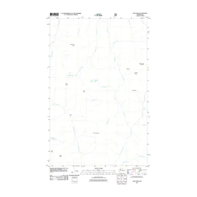
2011 Map of Lost Peak
USGS Topo · Published 2011About this map
Lost River and its numerous high-altitude tributaries carve through this section of the Cascade Range, defining a landscape of isolated peaks and alpine basins. The area is characterized by significant topographic relief, where water features like Johnny Lakes and Rampart Lake sit tucked beneath prominent summits. Human presence in this wilderness is minimal, represented by the remote Clints Cabin and the established Hoot Owl Camp. High-elevation passes such as Lucky Pass and Pistol Pass provide the only navigable routes through the complex terrain of Rampart Ridge. The map details a hydrographic network including Ptarmigan Creek and Auburn Creek, illustrating the drainage patterns that feed the river system below. Named peaks like Nanny Goat Mountain and Many Trails Peak serve as primary landmarks for navigation and land management.
Find a feature on this map
30 named features on this map. Tap any name to fly to it.
Don’t see what you’re looking for? This feature index may not catch every label — zoom into the map to look around manually.
Map Details
Editions of this 2011 Lost Peak Map
This is the sole edition of this map. No revisions or reprints were ever made.
Other maps of this area

1920 · Slate Pass
USGS Topo · 1:125,000

1955 · Concrete
USGS Topo · 1:250,000

1958 · Concrete
USGS Topo · 1:250,000

1962 · Concrete
USGS Topo · 1:250,000

1962 · Mazama
USGS Topo · 1:62,500
1963 · Robinson Mtn.
USGS Topo · 1:24,000

1969 · Lost Peak
USGS Topo · 1:24,000
1969 · Ashnola Mtn
USGS Topo · 1:24,000

1969 · Tatoosh Buttes
USGS Topo · 1:24,000

1969 · Billy Goat Mtn
USGS Topo · 1:24,000