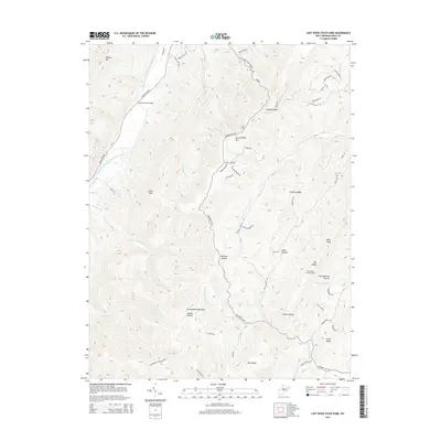
2014 Map of Lost River State Park
USGS Topo · Published 2014About this map
The South Fork South Branch Potomac River carves through this Hardy County landscape, where the Harness Ford Bridge provides a critical crossing in the northwest. The terrain is defined by the massive ridges of Shenandoah Mountain and South Branch Mtn, creating a series of deep drainages like Strawderman Hollow and Whetzel Hollow. High-elevation landmarks such as the Big Ridge Lookout Tower and Helmick Rock offer vantage points over the narrow runs and steep gaps. Local natural features like Lee Sulphur Spring and several family-named roads, including Jesse Landis Ln and Strawderman Rd, speak to the enduring human presence and land use within these mountain corridors.
Find a feature on this map
57 named features on this map. Tap any name to fly to it.
Don’t see what you’re looking for? This feature index may not catch every label — zoom into the map to look around manually.
Map Details
Editions of this 2014 Lost River State Park Map
This is the sole edition of this map. No revisions or reprints were ever made.
Other maps of this area

1891 · Romney
USGS Topo · 1:125,000

1892 · Franklin
USGS Topo · 1:125,000

1892 · Woodstock
USGS Topo · 1:125,000

1895 · Piedmont
USGS Topo · 1:125,000

1896 · Franklin
USGS Topo · 1:125,000

1920 · Petersburg
USGS Topo · 1:48,000

1920 · Moorefield
USGS Topo · 1:62,500

1921 · Orkney Springs
USGS Topo · 1:48,000

1921 · Petersburg
USGS Topo · 1:48,000

1921 · Greenland Gap
USGS Topo · 1:62,500