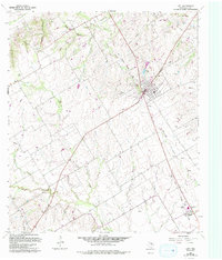
1963 Map of Lott
USGS Topo · Published 1993About this map
The town of Lott serves as the central hub of this Falls County survey, which documents a landscape transitioning through several decades of development. Originally compiled in the early 1960s with updates through the 1990s, the map reveals a rural economy shaped by both traditional agriculture and the emergence of the local oil industry, evidenced by numerous Oil Wells and a Drill Hole scattered across the eastern sections. An Old Railroad Grade indicates the path of former transit lines that once connected this region to larger markets.
Find a feature on this map
31 named features on this map. Tap any name to fly to it.
Don’t see what you’re looking for? This feature index may not catch every label — zoom into the map to look around manually.
Map Details
Editions of this 1963 Lott Map
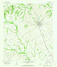
2 editions found
Other maps of this area

1892 · Temple
USGS Topo · 1:125,000

1954 · Waco
USGS Topo · 1:250,000

1955 · Waco
USGS Topo · 1:250,000

1957 · Bruceville
USGS Topo · 1:24,000

1957 · Chilton
USGS Topo · 1:24,000

1957 · Marlin
USGS Topo · 1:24,000

1962 · Rosebud
USGS Topo · 1:24,000

1962 · Cedar Springs
USGS Topo · 1:24,000
1963 · Westphalia
USGS Topo · 1:24,000
1963 · Seaton
USGS Topo · 1:24,000