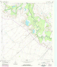
1962 Map of Lott Lake
USGS Topo · Published 1987About this map
The San Antonio River snakes through the center of this landscape, its complex meanders creating a dense network of oxbow lakes and named river bends. This riverine environment defines the local geography, featuring numerous water bodies such as Rice Lake, Summers Lake, and the map's namesake, Lott Lake. The terrain transitions from these lush river bottoms to higher ground marked by Cottonwood Hollow and active industrial infrastructure, including the Gaffney Oil Field and various pipelines.
Find a feature on this map
34 named features on this map. Tap any name to fly to it.
Don’t see what you’re looking for? This feature index may not catch every label — zoom into the map to look around manually.
Map Details
Editions of this 1962 Lott Lake Map
2 editions found
Other maps of this area

1953 · Beeville
USGS Topo · 1:250,000

1954 · Vidaurri
USGS Topo · 1:62,500

1954 · Refugio
USGS Topo · 1:62,500

1956 · Beeville
USGS Topo · 1:250,000

1960 · Beeville
USGS Topo · 1:250,000

1962 · Live Oak Lake
USGS Topo · 1:24,000

1962 · Fannin
USGS Topo · 1:24,000

1962 · Lott Lake
USGS Topo · 1:24,000

1962 · McFaddin
USGS Topo · 1:24,000

1962 · Hensley Lake
USGS Topo · 1:24,000