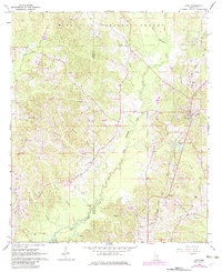
1968 Map of Louin
USGS Topo · Published 1982About this map
The Bienville National Forest dominates the northern reaches of this Mississippi landscape, where the terrain is intricately carved by the headwaters of Tallahala Creek. The town of Louin serves as a local hub along the Illinois Central Gulf railroad line, which cuts north-to-south through the eastern half of the map. This area, spanning the border of Smith and Jasper Counties, reveals a traditional rural settlement pattern centered on community landmarks. Genealogists will find numerous country churches and burial grounds, including Warren Hill Ch, Phaltie Ch, and Bethany Cem. The drainage network, featuring Buchanan Branch and Rosson Branch, illustrates the topographic complexity of the Piney Woods region before significant modern development, with a lone Oil Well marking the local extraction economy of the late 1960s.
Find a feature on this map
31 named features on this map. Tap any name to fly to it.
Don’t see what you’re looking for? This feature index may not catch every label — zoom into the map to look around manually.
Map Details
Editions of this 1968 Louin Map
2 editions found
Other maps of this area

1953 · Hattiesburg
USGS Topo · 1:250,000

1953 · Meridian
USGS Topo · 1:250,000

1957 · Meridian
USGS Topo · 1:250,000

1958 · Hattiesburg
USGS Topo · 1:250,000

1964 · Lake Como
USGS Topo · 1:24,000

1965 · Meridian
USGS Topo · 1:250,000

1968 · Clear Springs
USGS Topo · 1:24,000

1968 · Pineville
USGS Topo · 1:24,000

1968 · Louin
USGS Topo · 1:24,000

1968 · Louin SW
USGS Topo · 1:24,000