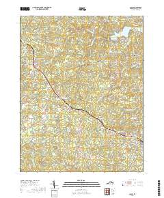
2019 Map of Louisa
USGS Topo · Published 2019About this map
The Louisa County Courthouse serves as the focal point of this Central Virginia landscape, anchoring the town of Louisa at the southeastern edge of the quadrangle. This 2019 survey documents the enduring spatial relationship between established crossroads like Trevilians and Green Springs and modern residential developments such as Blue Ridge Shores on the banks of Lake Louisa. The terrain is defined by a dense network of tributaries including Hickory Creek and Chaney Creek, which feed into various man-made reservoirs like Meyerton Lake and Small Country Lake. For family historians, several burial grounds are preserved in the record, including Oakland Cemetery and Hillcrest Cemetery. The map illustrates how historical settlements like Oakland and Mildred Crossing persist as vital points of reference amidst the shifting rural and suburban residential patterns of the 21st century.
Find a feature on this map
99 named features on this map. Tap any name to fly to it.
Don’t see what you’re looking for? This feature index may not catch every label — zoom into the map to look around manually.
Map Details
Editions of this 2019 Louisa Map
This is the sole edition of this map. No revisions or reprints were ever made.
Other maps of this area

1887 · Spottsylvania
USGS Topo · 1:125,000

1890 · Goochland
USGS Topo · 1:125,000

1891 · Palmyra
USGS Topo · 1:125,000

1892 · Spottsylvania
USGS Topo · 1:125,000

1892 · Goochland
USGS Topo · 1:125,000

1892 · Gordonsville
USGS Topo · 1:125,000

1895 · Palmyra
USGS Topo · 1:125,000

1897 · Palmyra
USGS Topo · 1:125,000

1942 · Mineral
USGS Topo · 1:31,680

1942 · Lahore
USGS Topo · 1:31,680