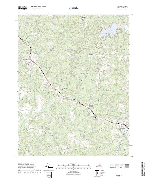
2022 Map of Louisa
USGS Topo · Published 2022About this map
The Louisa County Courthouse serves as the focal point of this Virginia interior, anchoring the seat of government within the town of Louisa. This 2022 survey captures the modern landscape of the Piedmont, where residential developments like Blue Ridge Shores and Cutalong interface with older rural settlements. The topography is defined by the branching tributaries of Hickory Cr, White Cr, and Chaney Cr, which feed several significant water bodies including Lake Louisa and Ponda Roche Lake. Cultural and family history is preserved through scattered burial grounds such as Oakland Cem, Hillcrest Cem, and Taylor Cem. The road network connects established locales like Green Springs and Trevelians, reflecting a pattern of growth that follows historic transit corridors through the undulating terrain near Mildred Crossing.
Find a feature on this map
96 named features on this map. Tap any name to fly to it.
Don’t see what you’re looking for? This feature index may not catch every label — zoom into the map to look around manually.
Map Details
Editions of this 2022 Louisa Map
This is the sole edition of this map. No revisions or reprints were ever made.
Other maps of this area

1887 · Spottsylvania
USGS Topo · 1:125,000

1890 · Goochland
USGS Topo · 1:125,000

1891 · Palmyra
USGS Topo · 1:125,000

1892 · Spottsylvania
USGS Topo · 1:125,000

1892 · Goochland
USGS Topo · 1:125,000

1892 · Gordonsville
USGS Topo · 1:125,000

1895 · Palmyra
USGS Topo · 1:125,000

1897 · Palmyra
USGS Topo · 1:125,000

1942 · Mineral
USGS Topo · 1:31,680

1942 · Lahore
USGS Topo · 1:31,680