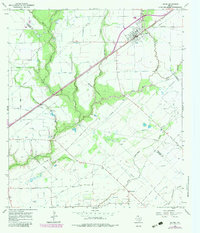
1965 Map of Louise
USGS Topo · Published 1983About this map
Louise stands as the primary hub of this Gulf Coast prairie landscape, positioned along the vital Southern Pacific railroad line. The settlement's infrastructure in the mid-1960s included the East Side Sch, a central Water Tank, and an Athletic Field, reflecting a community integrated with the rail economy. Beyond the town limits, the terrain is defined by the branching network of Mustang Creek, including its West Mustang, Middle Mustang, and East Mustang tributaries.
Find a feature on this map
27 named features on this map. Tap any name to fly to it.
Don’t see what you’re looking for? This feature index may not catch every label — zoom into the map to look around manually.
Map Details
Editions of this 1965 Louise Map
2 editions found
Other maps of this area

1952 · Francitas NW
USGS Topo · 1:24,000

1952 · Manson
USGS Topo · 1:24,000

1952 · Francitas NE
USGS Topo · 1:24,000

1953 · Beeville
USGS Topo · 1:250,000

1953 · Seguin
USGS Topo · 1:250,000

1956 · Beeville
USGS Topo · 1:250,000

1958 · Seguin
USGS Topo · 1:250,000

1960 · Beeville
USGS Topo · 1:250,000

1963 · Ganado
USGS Topo · 1:24,000

1965 · El Campo
USGS Topo · 1:24,000