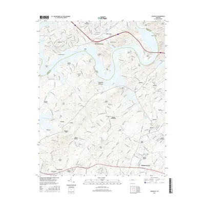
2016 Map of Louisville
USGS Topo · Published 2016About this map
Fort Loudoun Lake dominates the northern reaches of this region where Knoxville meets the northern border of Blount County. This landscape is defined by the winding Tennessee River channel and its many named points and bends, including Keller Bend, Toole Bend, and Stony Point. Further south, the map transitions into the rolling terrain of Blount County, where older rural community centers like Middle Settlement, Miser Station, and Moralfa sit among family cemeteries and early institutions like Holston College. The map captures the significant infrastructure of the Mc Ghee Tyson Airport alongside the industrial footprint of Alcoa and the growing residential outskirts of Maryville. Significant water features such as Lackey Creek and Pistol Creek drain the interior ridges, while historic landmarks like Mahoney Mill and the Zions Chapel Cemetery provide essential reference points for local history.
Find a feature on this map
75 named features on this map. Tap any name to fly to it.
Don’t see what you’re looking for? This feature index may not catch every label — zoom into the map to look around manually.
Map Details
Editions of this 2016 Louisville Map
This is the sole edition of this map. No revisions or reprints were ever made.
Other maps of this area

1886 · Knoxville
USGS Topo · 1:125,000

1892 · Knoxville
USGS Topo · 1:125,000

1894 · Knoxville
USGS Topo · 1:125,000

1895 · Loudon
USGS Topo · 1:125,000

1895 · Knoxville
USGS Topo · 1:125,000

1901 · Knoxville
USGS Topo · 1:125,000

1935 · Binfield
USGS Topo · 1:24,000

1935 · Knoxville
USGS Topo · 1:48,000

1935 · Meadow
USGS Topo · 1:24,000

1935 · Maryville
USGS Topo · 1:24,000