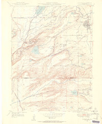
1950 Map of Louisville
USGS Topo · Published 1955About this map
The northern edge of the Boulder and Jefferson County line reveals a landscape transitioning from the coal-mining peaks of the late 1930s into the mid-century. A network of over a dozen coal operations, many marked as abandoned by the 1950 revision, defines the area between Marshall and Superior. Names like the New Red Ash Mine, Pittsburg Mines, and the Cracker Jack Mine trace the sub-bituminous coal seams underlying Davidson Mesa.
Find a feature on this map
49 named features on this map. Tap any name to fly to it.
Don’t see what you’re looking for? This feature index may not catch every label — zoom into the map to look around manually.
Map Details
Editions of this 1950 Louisville Map
This is the sole edition of this map. No revisions or reprints were ever made.
Other maps of this area

1899 · West Denver
USGS Topo · 1:125,000

1902 · Boulder
USGS Topo · 1:62,500

1904 · Niwot
USGS Topo · 1:62,500

1904 · Boulder
USGS Topo · 1:62,500

1906 · Blackhawk
USGS Topo · 1:62,500

1939 · Golden
USGS Topo · 1:24,000

1940 · Lafayette
USGS Topo · 1:31,680

1941 · Arvada
USGS Topo · 1:31,680

1942 · Eldorado Springs
USGS Topo · 1:24,000

1942 · Golden
USGS Topo · 1:31,680