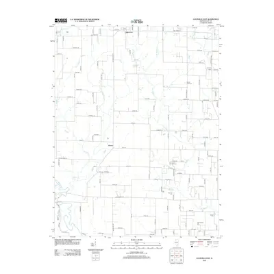
2012 Map of Louisville East
USGS Topo · Published 2012About this map
Bible Grove and the surrounding township terrain are characterized by a dense network of country cemeteries and the industrial footprint of the Sailor Springs Oil Field. This landscape is bisected by the Little Wabash River and its numerous tributaries, including Panther Cr and Little Muddy Cr, which dictate the rural road patterns. Genealogists will find an exceptional concentration of family and community burial grounds, from the Old Union Cem and Conly Cem in the northwest to Dillman Cem in the southeast. The settlement at Hoosier serves as a local landmark amidst a grid of roads with distinctive biblical names like Judea Dr, Elijah Rd, and Proverbs Ln, reflecting the cultural heritage of the Clay County area. The southern reaches of the map show the transition into the oil fields, where petroleum extraction has historically shaped the local economy and land use.
Find a feature on this map
110 named features on this map. Tap any name to fly to it.
Don’t see what you’re looking for? This feature index may not catch every label — zoom into the map to look around manually.
Map Details
Editions of this 2012 Louisville East Map
This is the sole edition of this map. No revisions or reprints were ever made.
Other maps of this area

1948 · Flora
USGS Topo · 1:62,500

1949 · Flora
USGS Topo · 1:62,500

1952 · Xenia
USGS Topo · 1:62,500

1953 · Sailor Springs
USGS Topo · 1:62,500

1956 · Edgewood
USGS Topo · 1:62,500

1958 · Belleville
USGS Topo · 1:250,000

1962 · Belleville
USGS Topo · 1:250,000
1968 · Xenia NE
USGS Topo · 1:24,000

1970 · Clay City
USGS Topo · 1:24,000
1970 · Flora
USGS Topo · 1:24,000