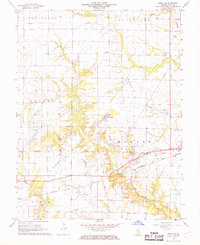
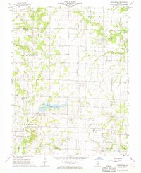
1968 Map of Xenia NE
USGS Topo · Published 1970About this map
The Baltimore and Ohio railroad corridor anchors the southern reaches of this Clay County landscape, where the small settlement of Kenner sits amidst a network of natural and industrial features. Surveyed in the late 1960s, the terrain is defined by the winding paths of Buck Creek, Raccoon Creek, and Brush Creek, with the man-made Trago Lake providing a focal point for the local hydrology. This era represents a period of significant petroleum extraction, evidenced by the extensive Oil Field and numerous Oil Well labels scattered across the townships of Songer and Harter. Genealogists will find a wealth of specific landmarks, including several country houses of worship like McCabe Chapel and Golden Ch, alongside established burying grounds such as Oak Mound Cem and Camp Ground Cem. The inclusion of the Lincoln Sch and even a drive-in Theater reflects the rural community structure of mid-century Illinois.
Find a feature on this map
29 named features on this map. Tap any name to fly to it.
Don’t see what you’re looking for? This feature index may not catch every label — zoom into the map to look around manually.
Map Details
Editions of this 1968 Xenia NE Map
2 editions found
Other maps of this area

1948 · Flora
USGS Topo · 1:62,500

1949 · Flora
USGS Topo · 1:62,500

1952 · Xenia
USGS Topo · 1:62,500

1953 · Sailor Springs
USGS Topo · 1:62,500

1956 · Edgewood
USGS Topo · 1:62,500

1958 · Belleville
USGS Topo · 1:250,000

1962 · Belleville
USGS Topo · 1:250,000
1968 · Orchardville
USGS Topo · 1:24,000
1968 · Xenia
USGS Topo · 1:24,000
1968 · Johnsonville
USGS Topo · 1:24,000