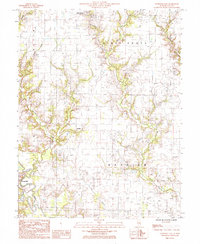
1985 Map of Louisville East
USGS Topo · Published 1985About this map
Louisville and the surrounding township of Hoosier are the focal points of this 1980s landscape in Clay County, where the meandering Wabash River meets its local tributaries. The map details a rural geography defined by the intersecting waters of Little Muddy Creek, Panther Creek, and Flat Branch. Settlements like Bible Grove and the small locality of Hoosier anchor the agricultural and utility network, which by this era included a significant infrastructure of pipelines and high-voltage energy corridors, such as the Double Steel Pole Transmission Line.
Find a feature on this map
19 named features on this map. Tap any name to fly to it.
Don’t see what you’re looking for? This feature index may not catch every label — zoom into the map to look around manually.
Map Details
Editions of this 1985 Louisville East Map
This is the sole edition of this map. No revisions or reprints were ever made.
Other maps of this area

1948 · Flora
USGS Topo · 1:62,500

1949 · Flora
USGS Topo · 1:62,500

1952 · Xenia
USGS Topo · 1:62,500

1953 · Sailor Springs
USGS Topo · 1:62,500

1956 · Edgewood
USGS Topo · 1:62,500

1958 · Belleville
USGS Topo · 1:250,000

1962 · Belleville
USGS Topo · 1:250,000
1968 · Xenia NE
USGS Topo · 1:24,000

1970 · Clay City
USGS Topo · 1:24,000
1970 · Flora
USGS Topo · 1:24,000