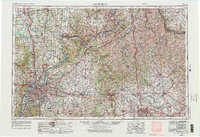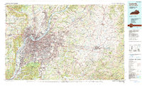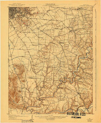
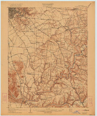
1907 Map of Louisville
USGS Topo · Published 1941About this map
Louisville serves as the focal point for this early 20th-century survey, which reveals the transition from urban density to the sprawling agricultural and river-oriented communities of Jefferson and Bullitt counties. The landscape is heavily defined by the meandering courses of Floyds Fork and the Salt River, where river crossings like Motherhead Ford and Bells Mill Ford provided vital transit before the expansion of modern bridges. Smaller crossroads like Seatonsville Malott PO and Okolona appear as modest hubs along historic turnpikes like the Bardstown Pike.
Find a feature on this map
66 named features on this map. Tap any name to fly to it.
Don’t see what you’re looking for? This feature index may not catch every label — zoom into the map to look around manually.
Map Details
Editions of this 1907 Louisville Map
3 editions found

Historical Maps of Louisville Through Time
5 maps found