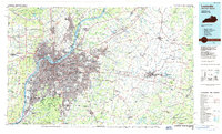
1986 Map of Louisville
USGS Topo · Published 1986About this map
The Ohio River serves as the dominant geographic and political spine for this mid-1980s regional overview, separating the dense urban core of Louisville from Indiana neighbors like Jeffersonville and New Albany. The landscape transition is starkly visible, moving from the industrial and residential grid of the city to the distinctive topography of the Knobs and Muldraugh Hill to the south and west. Significant institutional footprints are detailed, including the Fort Knox Military Reservation and the Indiana Army Ammunition Plant, reflecting the area's strategic importance during the late 20th century.
Find a feature on this map
264 named features on this map. Tap any name to fly to it.
Don’t see what you’re looking for? This feature index may not catch every label — zoom into the map to look around manually.
Map Details
Editions of this 1986 Louisville Map
2 editions found
Other maps of this area

1905 · Harrodsburg
USGS Topo · 1:125,000

1905 · Prospect
USGS Topo · 1:62,500

1906 · Lockport
USGS Topo · 1:48,000

1907 · Louisville
USGS Topo · 1:62,500

1908 · Lockport
USGS Topo · 1:62,500

1909 · Kosmosdale
USGS Topo · 1:48,000

1912 · Prospect
USGS Topo · 1:62,500

1912 · Kosmosdale
USGS Topo · 1:62,500

1922 · Frankfort
USGS Topo · 1:48,000

1923 · Waddy
USGS Topo · 1:48,000