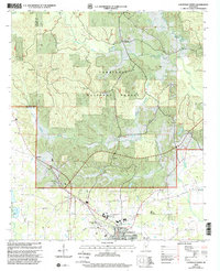
2000 Map of Louisville North
USGS Topo · Published 2002About this map
Tombigbee National Forest covers much of this landscape north of the city of Louisville, where the upper reaches of the Little Noxubee River and Murphy Creek define the local drainage. At the start of the millennium, the area reflects a deeply rooted rural infrastructure of small churches and family burial grounds that have long anchored these communities. Points of local significance include Gum Springs in the north and the McMillan settlement to the west. The landscape is dotted with generational landmarks such as Noxubee Hill Cem, Tanksley Cem, and Greenboro Ch. Transportation and local commerce are represented by the Louisville-Winston County Airport and active Sandpit operations, showing the slow evolution of Winston County as it balances timber management with municipal growth.
Find a feature on this map
25 named features on this map. Tap any name to fly to it.
Don’t see what you’re looking for? This feature index may not catch every label — zoom into the map to look around manually.
Map Details
Editions of this 2000 Louisville North Map
This is the sole edition of this map. No revisions or reprints were ever made.
Other maps of this area

1953 · West Point
USGS Topo · 1:250,000

1958 · West Point
USGS Topo · 1:250,000

1963 · West Point
USGS Topo · 1:250,000

1965 · Bradley
USGS Topo · 1:24,000

1972 · Louisville North
USGS Topo · 1:24,000

1972 · Highpoint
USGS Topo · 1:24,000
1972 · Louisville South
USGS Topo · 1:24,000
1972 · Louisville SW
USGS Topo · 1:24,000

1972 · Sturgis
USGS Topo · 1:24,000
1972 · Ackerman
USGS Topo · 1:24,000