
1972 Map of Highpoint
USGS Topo · Published 1973About this map
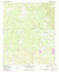
The boundary between Choctaw Co and Winston Co runs through a landscape defined by small rural congregations and the winding path of the Gulf Mobile and Ohio railroad. In the early 1970s, the community of Highpoint sat at a junction near the edge of the Tombigbee National Forest, where the terrain begins to rise toward the ridge. The map reveals a dense network of local spiritual and burial sites, from Big Jerusalem Ch and Sister Jerusalem Ch in the north to Owens Chapel Cem and Ebenezer Ch further south.
Find a feature on this map
31 named features on this map. Tap any name to fly to it.
Don’t see what you’re looking for? This feature index may not catch every label — zoom into the map to look around manually.
Map Details
Editions of this 1972 Highpoint Map
2 editions found
Other maps of this area

1953 · West Point
USGS Topo · 1:250,000

1958 · West Point
USGS Topo · 1:250,000

1963 · West Point
USGS Topo · 1:250,000

1966 · Weir
USGS Topo · 1:24,000

1968 · Weir
USGS Topo · 1:62,500

1972 · Louisville North
USGS Topo · 1:24,000

1972 · McCool
USGS Topo · 1:24,000
1972 · Ethel SE
USGS Topo · 1:24,000
1972 · Louisville South
USGS Topo · 1:24,000
1972 · Louisville SW
USGS Topo · 1:24,000