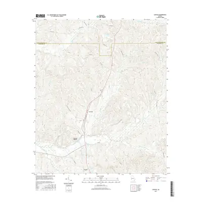
2017 Map of Louvale
USGS Topo · Published 2017About this map
Louvale and the neighboring Louvale Station sit at the center of this rural Stewart County landscape, where the terrain is deeply carved by a dense network of tributaries. The hydrology is dominated by Hichitee Cr to the north and the expansive Hannahatchee Cr system to the south, with numerous named family ponds like Williamsons Pond and Jenkins Pond scattered across the uplands. This area reflects a long-standing agricultural and timbering pattern, evidenced by the many secondary routes such as Moores Store Rd and Old Louvale Rd that follow the ridgelines between drainage basins. Armour Cem stands as a quiet genealogical marker near the center of the quadrangle, while the small settlement of Charles occupies the southern edge, illustrating the dispersed nature of local communities in this part of Georgia.
Find a feature on this map
40 named features on this map. Tap any name to fly to it.
Don’t see what you’re looking for? This feature index may not catch every label — zoom into the map to look around manually.
Map Details
Editions of this 2017 Louvale Map
This is the sole edition of this map. No revisions or reprints were ever made.
Other maps of this area

1908 · Columbus
USGS Topo · 1:62,500

1929 · Columbus
USGS Topo · 1:48,000

1947 · Columbus
USGS Topo · 1:62,500

1949 · Glen Alta
USGS Topo · 1:24,000

1949 · Julia
USGS Topo · 1:24,000

1949 · Cusseta
USGS Topo · 1:24,000

1950 · Fort Benning
USGS Topo · 1:24,000

1950 · Louvale
USGS Topo · 1:24,000

1950 · Lumpkin
USGS Topo · 1:24,000

1950 · Lumpkin SW
USGS Topo · 1:24,000