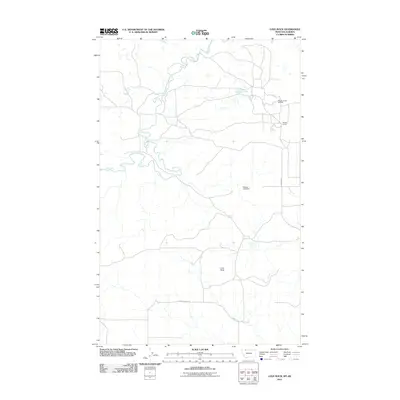
2011 Map of Love Rock
USGS Topo · Published 2011About this map
The Milk River meanders across this northern Montana landscape, anchoring a region defined by industrial extraction and topographic landmarks. Near the Canadian border, the Reagan Camp Oil Field and the adjacent settlement at Reagan Camp represent the area's energy history, served by the local network around Reagan Rd. The terrain is marked by significant natural elevations and water management features, including the eponymous Love Rock, the prominent Land Slide Butte to the south, and Reagan Lake Dam. These features suggest a working landscape where early 21st-century infrastructure, such as Antelope Spring, supports both cattle ranching and oil production in the high plains environment of Glacier County.
Find a feature on this map
8 named features on this map. Tap any name to fly to it.
Don’t see what you’re looking for? This feature index may not catch every label — zoom into the map to look around manually.
Map Details
Editions of this 2011 Love Rock Map
This is the sole edition of this map. No revisions or reprints were ever made.
Other maps of this area

1909 · Cut Bank
USGS Topo · 1:125,000

1911 · Blackfoot
USGS Topo · 1:125,000

1912 · Cut Bank
USGS Topo · 1:125,000

1960 · Cut Bank
USGS Topo · 1:250,000

1963 · Cut Bank
USGS Topo · 1:250,000

1964 · Cut Bank
USGS Topo · 1:250,000

1968 · Buffalo Lake
USGS Topo · 1:24,000
1968 · Dead Indian Spring
USGS Topo · 1:24,000
1968 · Love Rock
USGS Topo · 1:24,000

1968 · Rocky Buttes
USGS Topo · 1:24,000