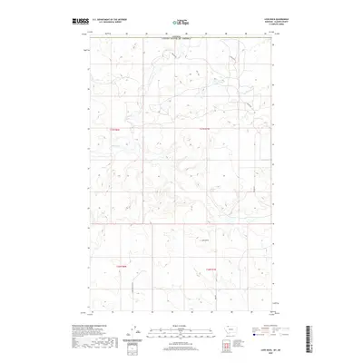
2020 Map of Love Rock
USGS Topo · Published 2020About this map
The Milk River meanders across the international boundary in this northernmost section of Glacier County, Montana, just south of the border with Canada. This high-plains landscape is characterized by its isolation and subtle natural landmarks, most notably the prominent terrain feature known as Love Rock. Grounded in the prairie environment, the area around Antelope Spring suggests a reliance on sparse water sources for livestock and local travel in an era defined by large-scale ranching and open-range land management. Transport is facilitated by few established routes, including Reagan Rd and Landslide Butte Rd, which connect the remote township and range sections of T37N and T36N. The map illustrates a borderlands geography where the lack of dense settlement emphasizes the significance of every named spring and geological formation for those navigating the northern Montana plains.
Find a feature on this map
10 named features on this map. Tap any name to fly to it.
Don’t see what you’re looking for? This feature index may not catch every label — zoom into the map to look around manually.
Map Details
Editions of this 2020 Love Rock Map
This is the sole edition of this map. No revisions or reprints were ever made.
Other maps of this area

1909 · Cut Bank
USGS Topo · 1:125,000

1911 · Blackfoot
USGS Topo · 1:125,000

1912 · Cut Bank
USGS Topo · 1:125,000

1960 · Cut Bank
USGS Topo · 1:250,000

1963 · Cut Bank
USGS Topo · 1:250,000

1964 · Cut Bank
USGS Topo · 1:250,000

1968 · Buffalo Lake
USGS Topo · 1:24,000
1968 · Dead Indian Spring
USGS Topo · 1:24,000
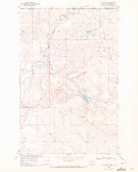
1968 · Love Rock
USGS Topo · 1:24,000

1968 · Rocky Buttes
USGS Topo · 1:24,000