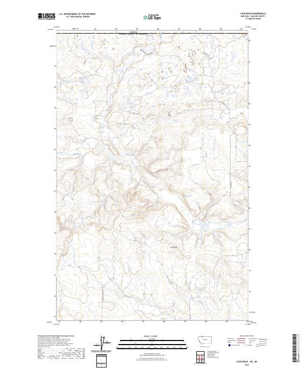
2024 Map of Love Rock
USGS Topo · Published 2024About this map
The Canada-United States border defines the northern edge of this landscape in northern Glacier County, where the meandering Milk River cuts a deep course through the high plains. The terrain is marked by distinct geological formations and essential water sources, including the prominent Love Rock and Antelope Spring further south. This 2024 survey captures the modern ranching and borderlands infrastructure of the region, anchored by historical transit routes like Reagan Rd and Landslide Butte Rd. The topography reveals the intricate drainage patterns feeding into the river system, reflecting the sparse but enduring settlement pattern of the Montana frontier.
Find a feature on this map
10 named features on this map. Tap any name to fly to it.
Don’t see what you’re looking for? This feature index may not catch every label — zoom into the map to look around manually.
Map Details
Editions of this 2024 Love Rock Map
This is the sole edition of this map. No revisions or reprints were ever made.
Other maps of this area

1909 · Cut Bank
USGS Topo · 1:125,000

1911 · Blackfoot
USGS Topo · 1:125,000

1912 · Cut Bank
USGS Topo · 1:125,000

1960 · Cut Bank
USGS Topo · 1:250,000

1963 · Cut Bank
USGS Topo · 1:250,000

1964 · Cut Bank
USGS Topo · 1:250,000

1968 · Buffalo Lake
USGS Topo · 1:24,000
1968 · Dead Indian Spring
USGS Topo · 1:24,000
1968 · Love Rock
USGS Topo · 1:24,000

1968 · Rocky Buttes
USGS Topo · 1:24,000