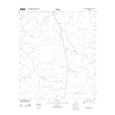
2013 Map of Lovelady South
USGS Topo · Published 2013About this map
Lovelady and the outlying community of Red Branch anchor this landscape in Houston County, where agricultural lands meet the complex drainage systems of the East Texas plains. Numerous small cemeteries, including Huffman Cem, Clapp Cem, and New Zion Cem, are scattered across the terrain, offering significant points of interest for genealogical research. The local economy and history are marked by the Trinity Oil Field and the Piney Woods Lookout Tower, reflecting a century of resource management and industrial activity.
Find a feature on this map
50 named features on this map. Tap any name to fly to it.
Don’t see what you’re looking for? This feature index may not catch every label — zoom into the map to look around manually.
Map Details
Editions of this 2013 Lovelady South Map
This is the sole edition of this map. No revisions or reprints were ever made.
Other maps of this area

1953 · Palestine
USGS Topo · 1:250,000

1954 · Beaumont
USGS Topo · 1:250,000

1957 · Beaumont
USGS Topo · 1:250,000

1957 · Palestine
USGS Topo · 1:250,000

1960 · Trinity West
USGS Topo · 1:24,000

1960 · Trinity East
USGS Topo · 1:24,000

1962 · Lovelady South
USGS Topo · 1:24,000

1962 · Glendale
USGS Topo · 1:24,000

1962 · Wyser Bottom
USGS Topo · 1:24,000

1963 · Lovelady North
USGS Topo · 1:24,000