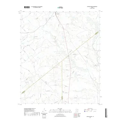
2019 Map of Lovelady South
USGS Topo · Published 2019About this map
Lovelady serves as the northern anchor for this rural Texas landscape where the boundaries of Houston, Trinity, and Walker counties converge. The terrain is defined by a dense network of tributaries including Tantabogue Cr, Elm Cr, and White Rock Creek, which carve through the countryside toward the Old Iron Bridge. For genealogists, the map is particularly valuable for its documentation of small, local burial sites such as Clapp Cem, Huffman Cem, and New Zion Cem. These sites, often located at the end of winding country roads like Chalk Cemetery Rd and Cemetery Rd, highlight the deep-rooted family history of this East Texas region. The presence of numerous family-named roads like Oates Brothers Rd and Jim McFarland Rd suggests a landscape shaped by generations of landholders and rural agricultural life.
Find a feature on this map
52 named features on this map. Tap any name to fly to it.
Don’t see what you’re looking for? This feature index may not catch every label — zoom into the map to look around manually.
Map Details
Editions of this 2019 Lovelady South Map
This is the sole edition of this map. No revisions or reprints were ever made.
Other maps of this area

1953 · Palestine
USGS Topo · 1:250,000

1954 · Beaumont
USGS Topo · 1:250,000

1957 · Beaumont
USGS Topo · 1:250,000

1957 · Palestine
USGS Topo · 1:250,000

1960 · Trinity West
USGS Topo · 1:24,000

1960 · Trinity East
USGS Topo · 1:24,000

1962 · Lovelady South
USGS Topo · 1:24,000

1962 · Glendale
USGS Topo · 1:24,000

1962 · Wyser Bottom
USGS Topo · 1:24,000

1963 · Lovelady North
USGS Topo · 1:24,000