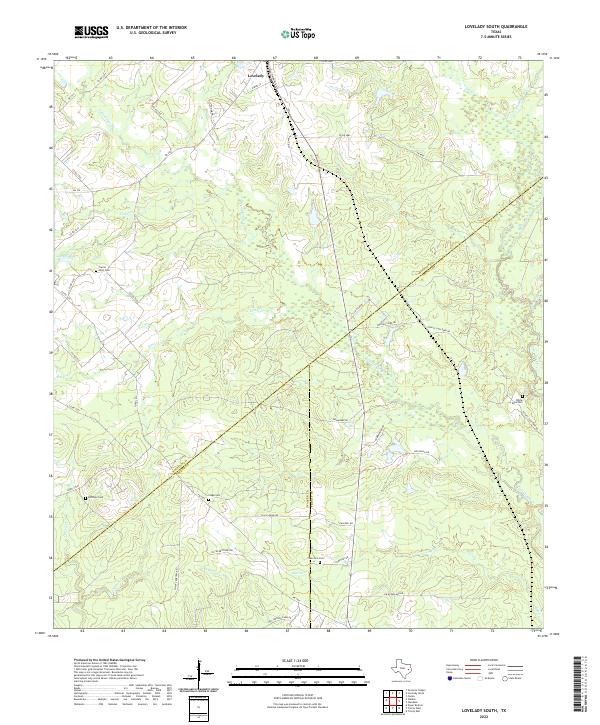
2022 Map of Lovelady South
USGS Topo · Published 2022About this map
The town of Lovelady sits at the northern edge of this East Texas survey, where the convergence of three counties — Houston, Walker, and Trinity — shapes the local geography. This landscape is defined by the winding drainages of Tantabogue Cr and White Rock Cr, which carve through a mix of woodland and agricultural clearings. The map reveals a deeply rooted rural community, evidenced by several family and community burial grounds including Prairie Point Cem, Huffman Cem, and Clapp Cem. Transportation patterns follow historic farm-to-market routes and named tracks like Old Johnson Farm Rd and Hay Ranch Rd, which connect the scattered homesteads. The intricate network of small waterways, such as Elm Cr and Chalk Cr, suggests a terrain managed for cattle and timber as the landscape transitions toward the southern piney woods region.
Find a feature on this map
50 named features on this map. Tap any name to fly to it.
Don’t see what you’re looking for? This feature index may not catch every label — zoom into the map to look around manually.
Map Details
Editions of this 2022 Lovelady South Map
This is the sole edition of this map. No revisions or reprints were ever made.
Other maps of this area

1953 · Palestine
USGS Topo · 1:250,000

1954 · Beaumont
USGS Topo · 1:250,000

1957 · Beaumont
USGS Topo · 1:250,000

1957 · Palestine
USGS Topo · 1:250,000

1960 · Trinity West
USGS Topo · 1:24,000

1960 · Trinity East
USGS Topo · 1:24,000

1962 · Lovelady South
USGS Topo · 1:24,000

1962 · Glendale
USGS Topo · 1:24,000

1962 · Wyser Bottom
USGS Topo · 1:24,000

1963 · Lovelady North
USGS Topo · 1:24,000