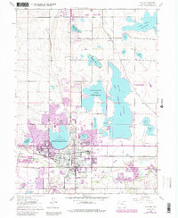
1962 Map of Loveland
USGS Topo · Published 1984About this map
Loveland serves as the central hub of this 1960s-era landscape, where the agricultural water needs of Larimer County are met by an extensive network of reservoirs and canals. Large bodies of water like Lake Loveland (Loveland and Greeley Res) and Horseshoe Lake (Seven Lakes Res) dominate the terrain, illustrating the region's historical reliance on irrigation. The map highlights the town's industrial and civic infrastructure, including the Sugar Refinery on the east side and educational landmarks like Loveland High Sch.
Find a feature on this map
47 named features on this map. Tap any name to fly to it.
Don’t see what you’re looking for? This feature index may not catch every label — zoom into the map to look around manually.
Map Details
Editions of this 1962 Loveland Map
4 editions found
Other maps of this area

1902 · Greeley
USGS Topo · 1:125,000

1906 · Loveland
USGS Topo · 1:62,500

1906 · Fort Collins
USGS Topo · 1:62,500

1907 · Livermore
USGS Topo · 1:125,000

1908 · Loveland
USGS Topo · 1:62,500

1908 · Fort Collins
USGS Topo · 1:62,500

1908 · Eaton
USGS Topo · 1:125,000

1909 · Livermore
USGS Topo · 1:125,000

1910 · Eaton
USGS Topo · 1:125,000

1950 · Windsor
USGS Topo · 1:24,000