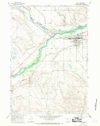
1966 Map of Lovell
USGS Topo · Published 1970About this map
The Shoshone River valley defines the landscape of this mid-1960s survey, where an intricate network of irrigation projects like the Sidon Canal and Elk-Lovell Canal turned the arid Big Horn Basin into a productive agricultural hub. Centered on the town of Lovell, the map documents a community deeply tied to both the land and industry, featuring a Chicago Burlington and Quincy railroad line and a local Drive-in Theater. Beyond the town limits, the geography transitions into the Oil Field near Byron, showing the dual importance of petroleum extraction and beet farming in this region.
Find a feature on this map
32 named features on this map. Tap any name to fly to it.
Don’t see what you’re looking for? This feature index may not catch every label — zoom into the map to look around manually.
Map Details
Editions of this 1966 Lovell Map
4 editions found
Other maps of this area

1955 · Cody
USGS Topo · 1:250,000

1958 · Cody
USGS Topo · 1:250,000

1962 · Cody
USGS Topo · 1:250,000

1964 · Lovell Lakes
USGS Topo · 1:24,000

1964 · Sykes Spring
USGS Topo · 1:24,000

1966 · Gilmore Hill NE
USGS Topo · 1:24,000

1966 · North Emblem Reservoir
USGS Topo · 1:24,000

1966 · Frannie
USGS Topo · 1:24,000

1966 · Cowley
USGS Topo · 1:24,000

1966 · Jack Horner Reservoir
USGS Topo · 1:24,000