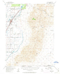
1956 Map of Lovelock
USGS Topo · Published 1963About this map
The Humboldt River corridor defines this mid-century landscape, where intensive irrigation supports the Upper Lovelock Valley and Lower Lovelock Valley. Centered on the town of Lovelock, the map documents a sophisticated network of water management including the Holmstrom Canal, Irish-American Canal, and Taylor Drain. This agricultural heartland is flanked by the steep terrain of the Humboldt Range to the east, which is dotted with resource extraction sites like the Muttlebury Mine and Willard Mine.
Find a feature on this map
46 named features on this map. Tap any name to fly to it.
Don’t see what you’re looking for? This feature index may not catch every label — zoom into the map to look around manually.
Map Details
Editions of this 1956 Lovelock Map
3 editions found

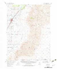
Other maps of this area

1908 · Carson Sink
USGS Topo · 1:250,000

1910 · Carson Sink
USGS Topo · 1:250,000

1931 · Lovelock
USGS Topo · 1:250,000

1935 · Lovelock
USGS Topo · 1:250,000

1951 · Carson Sink
USGS Topo · 1:62,500

1954 · Unionville
USGS Topo · 1:62,500

1954 · Buffalo Mtn
USGS Topo · 1:62,500

1955 · Lovelock
USGS Topo · 1:250,000

1956 · Oreana
USGS Topo · 1:62,500

1956 · Toulon
USGS Topo · 1:62,500