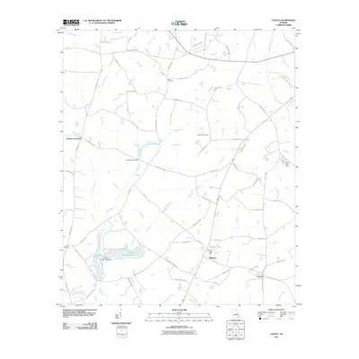
2011 Map of Lovett
USGS Topo · Published 2011About this map
Midway and Lovett anchor this rural landscape in Laurens County, Georgia, where the headwaters of the Ohoopee River begin to take shape. The terrain is defined by a series of impoundments and small watercourses, including Thunder Springs Lake, Jackson Pond, and Stanley Lake, each featuring its own small-scale dam. These water bodies, along with Big Creek and Big Branch, suggest a history of local water management for agriculture or recreation in the late twentieth century.
Find a feature on this map
68 named features on this map. Tap any name to fly to it.
Don’t see what you’re looking for? This feature index may not catch every label — zoom into the map to look around manually.
Map Details
Editions of this 2011 Lovett Map
This is the sole edition of this map. No revisions or reprints were ever made.
Other maps of this area

1957 · Macon
USGS Topo · 1:250,000

1958 · Macon
USGS Topo · 1:250,000

1962 · Oconee
USGS Topo · 1:24,000

1962 · Irwins Crossroads
USGS Topo · 1:24,000

1964 · Macon
USGS Topo · 1:250,000
1973 · Harrison
USGS Topo · 1:24,000

1974 · Cow Hell Swamp
USGS Topo · 1:24,000

1974 · Wrightsville
USGS Topo · 1:24,000

1974 · East Dublin
USGS Topo · 1:24,000

1974 · Lovett
USGS Topo · 1:24,000