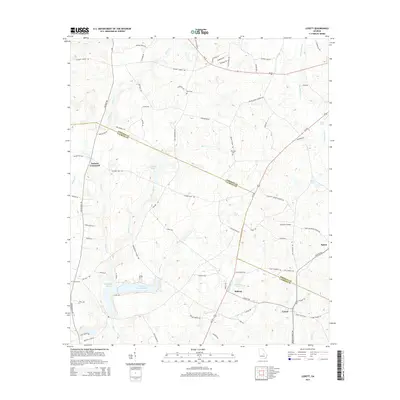
2014 Map of Lovett
USGS Topo · Published 2014About this map
Midway and Lovett sit at the southern edge of this landscape where the boundary between Johnson County and Laurens County angles through the central terrain. The area is defined by a dense network of country roads connecting small settlements and family landmarks, including Tuckers Crossroad to the west and the small community of Spann in the east. Local history is anchored by sites such as Dent Cemetery and Williams Cemetery, while the rural economy is represented by The Farm Airport north of Midway.
Find a feature on this map
87 named features on this map. Tap any name to fly to it.
Don’t see what you’re looking for? This feature index may not catch every label — zoom into the map to look around manually.
Map Details
Editions of this 2014 Lovett Map
This is the sole edition of this map. No revisions or reprints were ever made.
Other maps of this area

1957 · Macon
USGS Topo · 1:250,000

1958 · Macon
USGS Topo · 1:250,000

1962 · Oconee
USGS Topo · 1:24,000

1962 · Irwins Crossroads
USGS Topo · 1:24,000

1964 · Macon
USGS Topo · 1:250,000
1973 · Harrison
USGS Topo · 1:24,000

1974 · Cow Hell Swamp
USGS Topo · 1:24,000

1974 · Wrightsville
USGS Topo · 1:24,000

1974 · East Dublin
USGS Topo · 1:24,000

1974 · Lovett
USGS Topo · 1:24,000