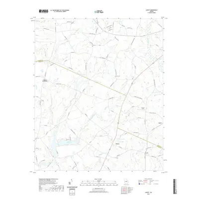
2020 Map of Lovett
USGS Topo · Published 2020About this map
Midway and Lovett anchor the landscape along the Johnson and Laurens county line in this contemporary Georgia survey. The region is defined by a dense network of local watercourses, including the Ohoopee River to the east and the intricate branching of Big Creek and Little Creek throughout the central terrain. While primarily rural and agricultural, the map reveals specific local infrastructure like The Farm Airport and several private airfields or small lakes such as Thunder Springs Lake and Stanley Lake. Genealogists will find value in the precisely marked locations of Dent, Williams, and Marvin cemeteries, which remain as quiet landmarks in the community. The road network connects small crossroads like Tuckers Crossroad and Spann, reflecting a settlement pattern that persists around these historic junctions.
Find a feature on this map
89 named features on this map. Tap any name to fly to it.
Don’t see what you’re looking for? This feature index may not catch every label — zoom into the map to look around manually.
Map Details
Editions of this 2020 Lovett Map
This is the sole edition of this map. No revisions or reprints were ever made.
Other maps of this area

1957 · Macon
USGS Topo · 1:250,000

1958 · Macon
USGS Topo · 1:250,000

1962 · Oconee
USGS Topo · 1:24,000

1962 · Irwins Crossroads
USGS Topo · 1:24,000

1964 · Macon
USGS Topo · 1:250,000
1973 · Harrison
USGS Topo · 1:24,000

1974 · Cow Hell Swamp
USGS Topo · 1:24,000

1974 · Wrightsville
USGS Topo · 1:24,000

1974 · East Dublin
USGS Topo · 1:24,000

1974 · Lovett
USGS Topo · 1:24,000