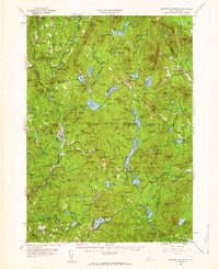
1957 Map of Lovewell Mountain
USGS Topo · Published 1959About this map
Pillsbury State Park and a network of state forests dominate this upland landscape where the borders of Sullivan, Cheshire, and Hillsborough counties converge. The terrain is defined by a dense concentration of water bodies and hills, from Millen Lake and Ashuelot Pond to the heights of Bean Mtn and Lovewell Mountain. Settlement is concentrated in small villages such as East Lempster and Washington, connected by the historic Dartmouth College Highway.
Find a feature on this map
160 named features on this map. Tap any name to fly to it.
Don’t see what you’re looking for? This feature index may not catch every label — zoom into the map to look around manually.
Map Details
Editions of this 1957 Lovewell Mountain Map
4 editions found
Other maps of this area

1898 · Monadnock
USGS Topo · 1:62,500

1898 · Keene
USGS Topo · 1:62,500

1900 · Peterboro
USGS Topo · 1:62,500

1902 · Sunapee
USGS Topo · 1:62,500

1905 · Sunapee
USGS Topo · 1:62,500

1907 · Sunapee
USGS Topo · 1:62,500

1926 · Hillsboro
USGS Topo · 1:62,500

1926 · Claremont
USGS Topo · 1:62,500

1927 · Bellows Falls
USGS Topo · 1:48,000

1928 · Mount Kearsarge
USGS Topo · 1:62,500