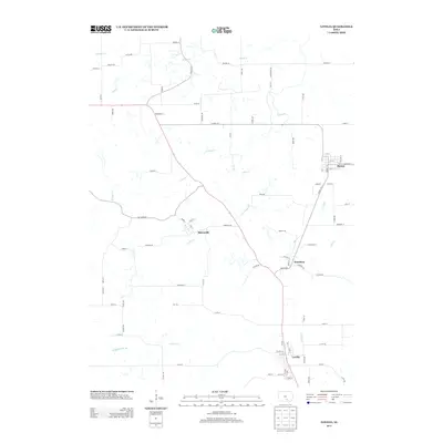
2013 Map of Lovilia
USGS Topo · Published 2013About this map
Lovilia and its northern neighbors anchor this rural Iowa landscape as it appeared in the early 21st century. The survey reveals a region defined by a intricate network of waterways, most notably Cedar Cr and its northern branch, N Cedar Cr, which meander through the central and western sections of the quadrangle. The small settlements of Marysville, Hamilton, and Bussey are connected by a grid of county highways and named secondary roads like Co Hwy-G71 and Pumkinvine Rd. In the southern portion of the map, Lovilia serves as a local hub, situated near the headwaters of Coal Cr. This map is particularly useful for researchers studying the geographic layout of southern Iowa townships, illustrating how modern road names like Reagan St and Sheridan St intersect with natural features like Whippoorwill Br and Honey Cr.
Find a feature on this map
89 named features on this map. Tap any name to fly to it.
Don’t see what you’re looking for? This feature index may not catch every label — zoom into the map to look around manually.
Map Details
Editions of this 2013 Lovilia Map
This is the sole edition of this map. No revisions or reprints were ever made.
Other maps of this area

1909 · Knoxville
USGS Topo · 1:62,500

1910 · Pella
USGS Topo · 1:62,500

1912 · Knoxville
USGS Topo · 1:62,500

1912 · Pella
USGS Topo · 1:62,500

1924 · Melcher
USGS Topo · 1:62,500

1929 · Albia
USGS Topo · 1:62,500

1954 · Des Moines
USGS Topo · 1:250,000

1956 · Des Moines
USGS Topo · 1:250,000

1957 · Des Moines
USGS Topo · 1:250,000
1965 · Knoxville
USGS Topo · 1:24,000