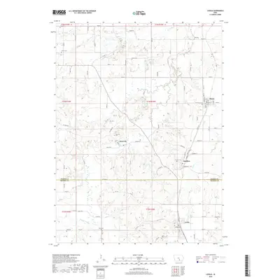
2018 Map of Lovilia
USGS Topo · Published 2018About this map
Lovilia and Marysville anchor this 2018 survey of the southern Iowa landscape, where the border between Marion Co and Monroe Co bisects a region defined by its creek valleys and rural cemeteries. The northern half of the sheet features the settlements of Bussey and Hamilton, connected by a network of county roads like Hwy G71 and Co Hwy T17. The terrain is carved by the winding paths of Cedar Creek, Coal Creek, and the Whippoorwill Branch, which dictate the placement of local homesteads and transportation routes.
Find a feature on this map
54 named features on this map. Tap any name to fly to it.
Don’t see what you’re looking for? This feature index may not catch every label — zoom into the map to look around manually.
Map Details
Editions of this 2018 Lovilia Map
This is the sole edition of this map. No revisions or reprints were ever made.
Other maps of this area

1909 · Knoxville
USGS Topo · 1:62,500

1910 · Pella
USGS Topo · 1:62,500

1912 · Knoxville
USGS Topo · 1:62,500

1912 · Pella
USGS Topo · 1:62,500

1924 · Melcher
USGS Topo · 1:62,500

1929 · Albia
USGS Topo · 1:62,500

1954 · Des Moines
USGS Topo · 1:250,000

1956 · Des Moines
USGS Topo · 1:250,000

1957 · Des Moines
USGS Topo · 1:250,000
1965 · Knoxville
USGS Topo · 1:24,000