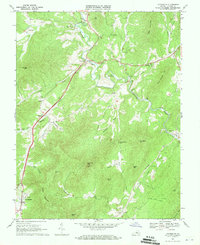
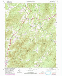
1967 Map of Lovingston
USGS Topo · Published 1970About this map
Lovingston serves as a primary settlement point in this Piedmont landscape, situated just south of the distinctive Peebles Mountain. The 1967 survey captures a rural network of small communities and crossroads such as Adial, Myndus, and Woods Mill, all connected by the Old Stage Road. The drainage of the Rockfish River dictates the local geography, featuring a sharp bend known as The Horseshoe and several prominent peaks including Sugarloaf Mtn and Mosby Mtn.
Find a feature on this map
47 named features on this map. Tap any name to fly to it.
Don’t see what you’re looking for? This feature index may not catch every label — zoom into the map to look around manually.
Map Details
Editions of this 1967 Lovingston Map
5 editions found
Other maps of this area

1892 · Buckingham
USGS Topo · 1:125,000

1929 · Covesville
USGS Topo · 1:62,500

1935 · Covesville
USGS Topo · 1:62,500

1943 · Lovingston
USGS Topo · 1:62,500

1945 · Covesville
USGS Topo · 1:62,500

1946 · Lovingston
USGS Topo · 1:62,500

1947 · Roanoke
USGS Topo · 1:250,000

1959 · Roanoke
USGS Topo · 1:250,000

1961 · Shipman
USGS Topo · 1:62,500

1961 · Buckingham
USGS Topo · 1:62,500