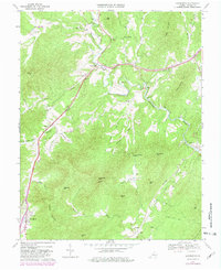
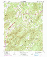
1967 Map of Lovingston
USGS Topo · Published 1981About this map
Lovingston serves as the focal point for this section of Nelson County, where the landscape is defined by the winding course of the Rockfish River and its numerous tributaries like Dutch Creek and Buck Creek. The map documents a predominantly rural and religious community structure, evidenced by the distribution of several country churches including Adial Ch, Cedar Grove Ch, and Ebenezer Ch. The presence of Lawhorne Mill and Woods Mill indicates the historical importance of water-powered industry along the riverbanks, while the Southern Grade reflects the corridor's transportation history.
Find a feature on this map
47 named features on this map. Tap any name to fly to it.
Don’t see what you’re looking for? This feature index may not catch every label — zoom into the map to look around manually.
Map Details
Editions of this 1967 Lovingston Map
5 editions found
Other maps of this area

1892 · Buckingham
USGS Topo · 1:125,000

1929 · Covesville
USGS Topo · 1:62,500

1935 · Covesville
USGS Topo · 1:62,500

1943 · Lovingston
USGS Topo · 1:62,500

1945 · Covesville
USGS Topo · 1:62,500

1946 · Lovingston
USGS Topo · 1:62,500

1947 · Roanoke
USGS Topo · 1:250,000

1959 · Roanoke
USGS Topo · 1:250,000

1961 · Shipman
USGS Topo · 1:62,500

1961 · Buckingham
USGS Topo · 1:62,500