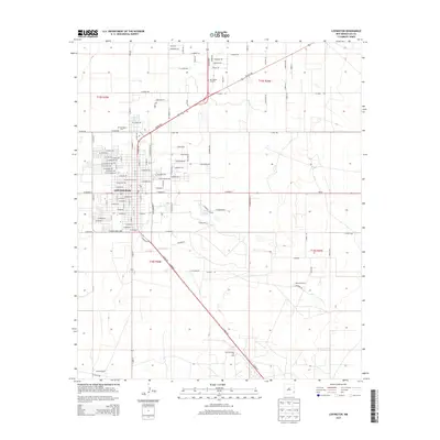
2013 Map of Lovington
USGS Topo · Published 2013About this map
Lovington serves as the focal point of this high-plains landscape, where the town's grid is defined by a series of avenues named for American presidents and trees. The map reveals the vital role of the petroleum industry in this region, anchored by the East Lovington Oil Field situated south of the main settlement. Beyond the town limits, the landscape transitions into a pastoral expanse characterized by large-scale landholdings such as Montieth Ranch and Graham Ranch. Key transit corridors like Plains Hwy and Tatum Hwy intersect here, facilitating the movement of goods and people across Lea County. Notable local landmarks including the Lovington Cem and the central Po provide essential touchpoints for genealogical research, while Twin Lakes offers a rare natural hydrological feature in this arid environment.
Find a feature on this map
80 named features on this map. Tap any name to fly to it.
Don’t see what you’re looking for? This feature index may not catch every label — zoom into the map to look around manually.
Map Details
Editions of this 2013 Lovington Map
This is the sole edition of this map. No revisions or reprints were ever made.
Other maps of this area

1954 · Hobbs
USGS Topo · 1:250,000

1954 · Brownfield
USGS Topo · 1:250,000

1958 · Brownfield
USGS Topo · 1:250,000

1958 · Hobbs
USGS Topo · 1:250,000

1962 · Brownfield
USGS Topo · 1:250,000

1962 · Lovington
USGS Topo · 1:24,000

1962 · Lovington
USGS Topo · 1:62,500

1969 · Humble City
USGS Topo · 1:24,000

1970 · Prairieview
USGS Topo · 1:24,000

1970 · Hillburn City
USGS Topo · 1:24,000