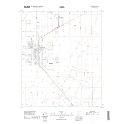
2023 Map of Lovington
USGS Topo · Published 2023About this map
Lovington serves as the focal point of this Lea County survey, revealing the organized grid and civic heart of the community. At the center of the township, the Lea County Courthouse stands as a primary landmark, surrounded by a dense network of residential and commercial streets such as E Gum Ave and W Jefferson Ave. The layout reflects a mix of civic infrastructure and local memory, with both the Lovington Cem and Resthaven Cem providing important touchstones for genealogical research. Beyond the developed city center, the landscape transitions into industrial and agricultural corridors, marked by features like Power Plant Ln and the Twin Lakes to the southeast. The survey clearly delineates the surrounding rural sections, including Smith Rd and Lone Star Ln, illustrating the expansion of the town into the surrounding high plains of Eastern New Mexico.
Find a feature on this map
71 named features on this map. Tap any name to fly to it.
Don’t see what you’re looking for? This feature index may not catch every label — zoom into the map to look around manually.
Map Details
Editions of this 2023 Lovington Map
This is the sole edition of this map. No revisions or reprints were ever made.
Other maps of this area

1954 · Hobbs
USGS Topo · 1:250,000

1954 · Brownfield
USGS Topo · 1:250,000

1958 · Brownfield
USGS Topo · 1:250,000

1958 · Hobbs
USGS Topo · 1:250,000

1962 · Brownfield
USGS Topo · 1:250,000

1962 · Lovington
USGS Topo · 1:24,000

1962 · Lovington
USGS Topo · 1:62,500

1969 · Humble City
USGS Topo · 1:24,000

1970 · Prairieview
USGS Topo · 1:24,000

1970 · Hillburn City
USGS Topo · 1:24,000