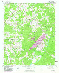
1964 Map of Lowell
USGS Topo · Published 1983About this map
Chattahoochee River frontage and the industrial development of the early 1980s define this landscape where Carroll, Heard, and Coweta counties meet. A significant mid-century update captures the Hal B Wansley Power plant with its associated conveyors and substations, marking a transition from the area's rural agricultural roots to its role in regional power generation. The Central of Georgia rail line runs parallel to the river, servicing the industrial corridor.
Find a feature on this map
44 named features on this map. Tap any name to fly to it.
Don’t see what you’re looking for? This feature index may not catch every label — zoom into the map to look around manually.
Map Details
Editions of this 1964 Lowell Map
2 editions found
Other maps of this area

1889 · Tallapoosa
USGS Topo · 1:125,000

1891 · Marietta
USGS Topo · 1:125,000

1892 · Tallapoosa
USGS Topo · 1:125,000

1895 · Marietta
USGS Topo · 1:125,000

1897 · Marietta
USGS Topo · 1:125,000

1897 · Tallapoosa
USGS Topo · 1:125,000

1899 · Wedowee
USGS Topo · 1:125,000

1901 · Marietta
USGS Topo · 1:125,000

1902 · Wedowee
USGS Topo · 1:125,000

1953 · Atlanta
USGS Topo · 1:250,000